Maps of the farm and village
Maps of the farm and village
Maps of the farm and village
Maps of the farm and village
2 of 2
We think the history of the farm and the village and how they have changed over time is really interesting. We developed a tool where you can see where you are standing today and what part of the farm that might have been in a different time! If you are wandering around the farm, keep an eye on the map below and see what the field you are on would have been in the past.
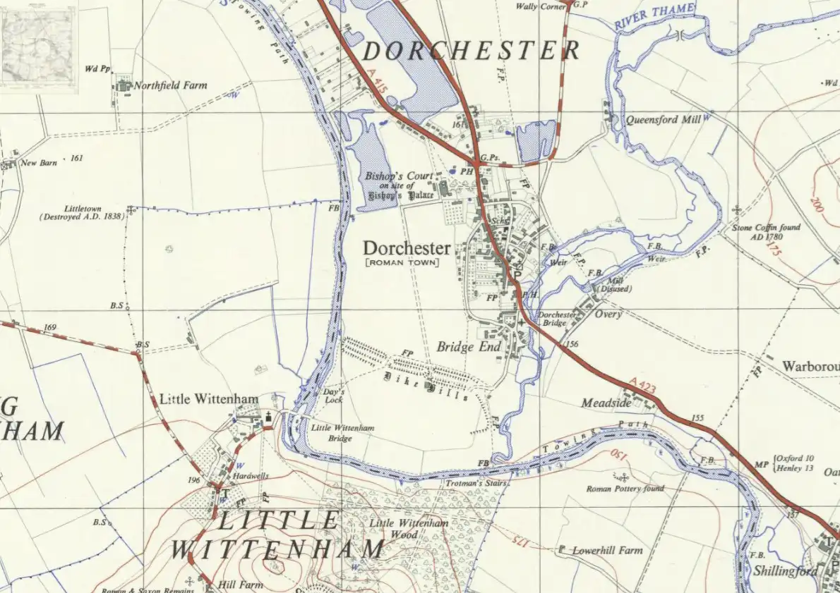
This map shows how Dorchester looked in the 1840s.
Transparency:
Early 20th Century Maps
If you zoom in and out of the map below it will take you through maps of different scales from the early 20th century in the UK. When you zoom in closely you will be able to see the farm and the village in detail.
They are all ordnance survey maps that vary in scale. The smallest scale is 1:10,560 from 1888-1913, next is 1:63,360 from 1885-1903, then 1:253,440 from 1905, and finally 1:1 million from 1905.
Even going back hundreds of years a lot of the land around Dorchester has changed very little. The footpaths have been in the same places for extremely long periods of time. For example, the path beside the lakes towards the Dyke Hills has been there since the Iron Ages around 3000 years ago. Several other roads around Dorchester were built by the Romans 2000 years ago. Whilst we do not have maps available for all of these periods, it is fascinating to think about what a history Dorchester has had and what evidence we can still see of it today.
You may have noticed on several maps that Bishop's Court is on the site of what was Bishop's Palace. It is believed there was a palace on the site of the farm house. This dated to the time of Dorchester being a cathedral town many centuries ago, and would have been the home of the bishop.
Have a look at some of the other old maps we have found!
We have found a range of old maps dating from the 16th century through to the 20th century. Some are closeups of the village - you can see from the 1960s map that the gravel pits were only partially dug at that point. Others are larger scale maps covering the whole county and beyond.